Corkagh to Clondalkin Village
Corkagh Park now merges with Clondalkin Park and you can walk east though the parkland to Clondalkin village crossing the Fonthill Road South via gates and pedestrian lights.
You will follow the course of the Camac river passing an area known as The Commons on old maps. These commons were open fields where local people could grow crops on narrow strips of land.
I guess they were the 18th century equivalent of allotments. This land is now given over to playing pitches.
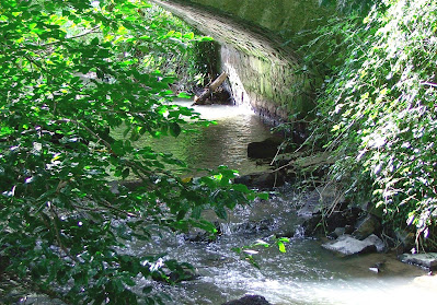
Further along you will pass by weirs, mill ponds and diversions of the Camac which are all that remain of the mills that once operated from here.
There are a pair of egrets who hunt for fish in the ponds along the Camac at Corkagh and Clondalkin and were recently spotted at the mill pond near the community centre.
 |
| Egret |
The Caldbeck family, who had a large house situated in the grounds of the adjacent Moyle Park College, owned and operated a mill here for almost 200 years.
 |
| Millpond near Clondalkin Village. |
history and wildlife of the area.
 |
| Open image to view |
 |
| Open image to view |
A walk from Corkagh to Clondalkin will bring you towards the Round Tower which has long been a symbol of our village. Built about 790 a.d, it still stands proud despite the constant traffic passing just a few feet away from its foundations. The tower was built to protect the monks and the valuable treasures of the monastery not only from Viking raiders but also from neighbouring monasteries. In fact there is a record of a dispute between the Abbots of the monasteries at Clondalkin and Tallaght which turned violent and led to damage to property and loss of life around the time the tower was constructed.
All images copyright of the author


