The Camac River at Corkagh.
The Camac river runs through Corkagh and as you walk around the park you will cross it or one of its streams via several pretty 19th century bridges.
 |
| 19th century bridge over the Camac |
The Camac rises in the Dublin Mountains southeast of Saggart and runs through Clondalkin, then on to Bluebell and Kilmainham before flowing into the Liffey near Heuston Station. Many mills were built alongside the river including flour, gunpowder and oil mills.
The four Corkagh lakes are also fed by the river and its streams.
 |
The Camac had a tendency to overflow its banks during wet periods. The Watery Lane near Clondalkin village was particularly prone to flooding. The lakes at Corkagh were created in 2000 as part of measures to prevent this flooding.
 |
| Carved stone on bridge near Baseball Fields/Walled Garden. This was added to the bridge in the 1960s. |
Here are some excerpts from a piece written in 1940 titled Little Rivers of Dublin by Lily O Brennan:
'The Camac is not indeed, a very long river, but it bears, or has borne, at least four names in several parts of its course; for it is called upon the maps the Brittas River, the Clondalkin River, and the Bluebell River, at these places; but its real and right name is the Camac, or, if we wish, the Cammock, which it derives from its winding, crooked course.'

'The source of the Camac is in Seahan Mountain, whence it flows through Ballinascorney to Talbotstown, where it meets a stream from Butter Mountain and with it forms the boundary between Dublin and Wicklow counties. At Aughfarrell a dam turns the greater part of its waters into an artificial channel which leads it to Brittas Ponds, well known to the anglers of Dublin. From Brittas the Camac flows down the picturesque little glen, the Sade of Saggart, and passes the old paper mills. Then its course lies through Corkagh, Baldonnel, and Clondalkin, to Bluebell winding glen from which the district took its name - Crum Glinn, the crooked glen - which was formerly on the north-west of the old village. We follow it as it makes it way by Inchicore until we look over the old stone wall which years ago protected Swifts orchard, and see its dark waters below Kilmainham Gaol; if we walk down the old coach road behind the late Royal Hospital we still see it below us. Near here, it formerly sent off a branch to work the mills of Usher's Island, but today it flows away by Swift's Hospital and Steevens's Hospital, to pass right under Kingsbridge Station and enter the Liffey'
The Sruleen Stream
Among the streams running through the park towards the Camac is the Sruleen stream after which a nearby parish is named. It flowed from a well that was located next to the Dog Run. The well has been dry for a couple of decades due to road widening on the nearby N7. The stream provided water for the big house in the 19th century. The walled channel, along which it ran towards Corkagh house, has recently been revealed with the removal of undergrowth. You can follow this channel as it winds its way between the Arboretum and Playground before it ends near the Camac.
 |
| Sruleen Well near the Dog Run |
 |
| Channel of the Sruleen stream running towards Corkagh House |
 A natural spring 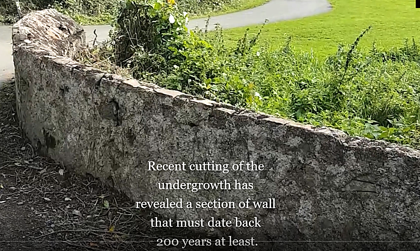 A spring emerges from underground close to the fishing lakes. An old stone wall, recently revealed when the ivy was cut away, reveals details of the 19th century bridge beneath which it flows. The stream continues along the back lane where it merges with another stream before flowing in to Swan Lake.  This spring never dries out even in periods of drought. Many people assume this this is water seeping from the lakes but it actually flows underground from the direction of Kilmatead. In a 19th century map this is marked as a well. |
The Mill Stream A third stream flows towards Corkagh from the old Mill pond situated at the south western edge of the fishing lakes where the ruins of a mill building and wheel can be found. This stream rushes down a millrace (pictured below) and then underground through a stone lined tunnel for a short distance before emerging alongside the fairy woods to eventually join with the waters of the nearby spring behind the old estate buildings.  This stream formed the basis of a pretty water garden near the old house. Traces of steps and a miniature harbour where the children of Corkagh House sailed their toy boats can still be seen today. There is also a small island area in the centre of the stream. I am told by someone that remembers Corkagh before it was a public park that there was a wrought iron table and chairs on this little island to provide a picnic space for the children of the Finlay Colley family in the early 20th century. The remains of this water garden can be found near the wooden bridge that links the fishing lakes to the estate cottages.  The stream from the Mill pond and the stream from the spring merge behind the Estate Buildings then flow along the back lane towards Swan Lake. |