From St Johns Wood along the back avenue..
The main entrance to the historic Corkagh House was from the Naas Road but the second and busier entrance was located along a narrow route from Clondalkin Village that led towards the gate to Fairview Oil Mills (which can be seen just opposite the St Johns Carpark). The entrance to Corkagh and a gate lodge were located a little way past the Oil Mills gate. This little road that gives access to the car park is part of the old Commons Road which followed roughly the route of the present St Johns Road West, then crossed what is now the Fonthill Road to join the Boot Road about opposite the Church/Convent
For many centuries the land on either side of the road was divided in to thin strips of fields which were reserved for the use of the citizens of Clondalkin village. These fields were known as Commons and it was from these that the road got its name.
 |
| Griffiths map of Corkagh/Clondalkin dating to circa 1850 with overlaid text indicating present day features. map courtesy of askaboutireland.ie |
 |
| This map from the early 1800s shows the back lane highlighted in yellow. The Blue mark indicates the entrance gate to the Oilmills and the Red mark indicates the location of the present days St Johns Wood Car park. Image courtesy of SDCC. |
The Finlay family who lived at Corkagh for over 200 years worshipped at the old Protestant church in Clondalkin village and we can imagine their carriage passing here on their way home from Sunday Worship. From the entrance to Corkagh an avenue led to the front of the house following the route of the present path in front of the playground.
The back lane, continued straight towards the rear of the house and the stables, farm buildings and walled gardens. This path was used by servants, farm workers and tradesmen and retains the old world charm of a country lane.

While we can still enjoy the shade of tall trees as we walk along the path it is interesting to remember that until the 19th century this part of Corkagh was more heavily wooded.
 |
Back avenue in spring
|
Along the lane you will notice ditches on both sides. Walking towards the fishing lakes the ditch on the left behind the Playground once carried water from the Sruleen Well (located near the dog run). The Sruleen well dried up in recent decades following works on the Naas Road but it once supplied water to Corkagh House. It was channelled down towards the House and then diverted along a ditch that runs between the playground and arboretum and along the back lane towards the Camac. These features are still visible at Corkagh today.
 |
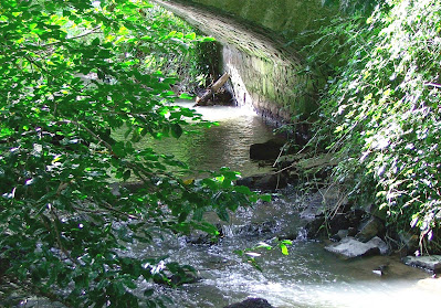
| At some points along the lane the streams cross from one side to the other under pretty old bridges. |
Near the top of the lane a further two streams merge. One flows down from the Mill Pond at the upper fishing lake (it originates from the Fettercairn Stream) and the other comes from a spring that rises at the lower fishing lake. Even in dry spells these streams never run dry.
 |
| Behind the council yard there is a section of the stream where Crayfish can occasionally be found |
 |
| This area is a popular paddling spot for kids. |
Opposite this part of the stream is the old wall surrounding the estate buildings. These buildings were a hub of activity and the heart of the Corkagh estate and farm.
During the first half of the 20th century the Finlay Colley family ran a successful dairy business here. On the right hand side of the lane you can see an low walled entrance crossing the stream to the field. There were large cattle sheds here where milking was done. Those sheds are long gone though the entrance remains however the council have added an ugly compound for machinery which somewhat spoils the view.
 |
| Corkagh Dairy vans on their way to deliver fresh milk to the residents of Clondalkin and beyond. (This image is included in a wonderful book by Joe Devine called The House of Corkagh). |
More recently, in the 1960s and 70s the stables and yard formed the core of Treemare Stud, owned by a wealthy Australian, John Galvin, and managed by the famous Harty family.
 |
| A line of derelict cottages at the rear of the yard can be seen from the lane. These housed the dairy men who rose before daybreak to milk the Corkagh cattle. |
 |
| 19th century estate buildings, now part of the council depot, viewed from the other side of the lane. |
 |
| Bridge with old estate buildings and dairy cottages in the background. |
 |
| Snowdrops in February |
This lovely lane is a favourite of many regular visitors to the park. From early February the way is lined by lines of Snowdrops and by March the vibrant yellow of the Fig Buttercups rival the Daffodils growing elsewhere in the park. In early May it is time for the creamy white Cowslips to signal the start of Summer and Ramsons, our native wild Garlic, line the lane.
 |
| In May and early June the lane is lined with Cow Parsley. |
 |
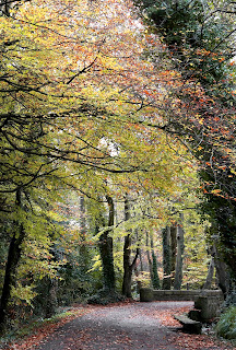
| Autumn is a lovely time to enjoy the lane. |
 |
Wild Garlic, which are also known as Ramsons, grow along the back lane. The plant produces white flowers from April to June. The smell is unmistakably
garlicky! |
 |
| If you are walking the back avenue in September or October watch out for the lovely little Cyclamen growing along the ditch. |
All images copyright of the author unless otherwise credited.


